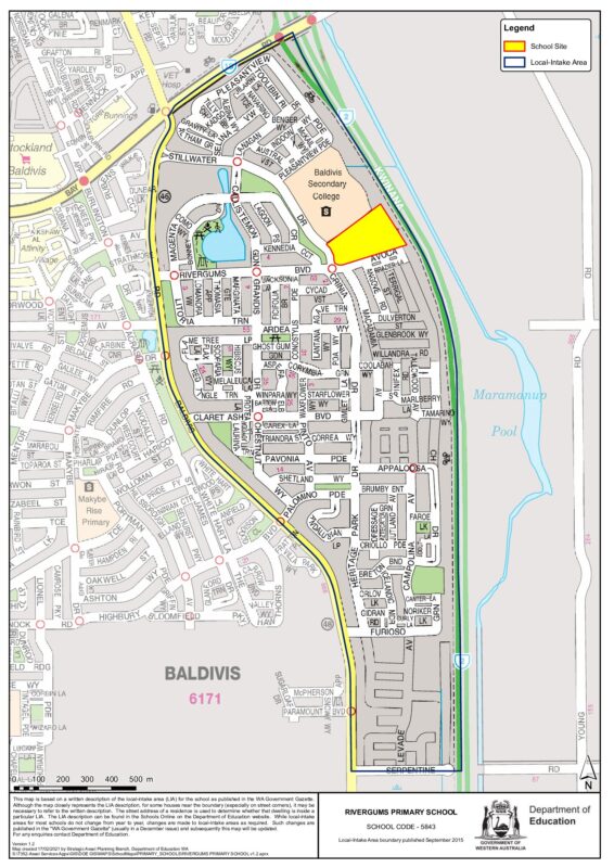
The following defines the local-intake area of this school:
RIVERGUMS PRIMARY SCHOOL (Government Gazette Dec 1998)
The boundary for this school is as follows:
From the intersection of the Kwinana Freeway and Safety Bay Road, west along Safety Bay Road (south side included) to Baldivis Road, south along Baldivis Road (east side included) to Serpentine Road, east along Serpentine Road (north side included) to the Kwinana Freeway, and north along the Kwinana Freeway (west side included) to Safety Bay Road.
Although the map closely represents the LIA description, for some houses near the boundary (especially on street corners), it may be necessary to refer to the written description. The street address of a residence is used to determine whether that dwelling is inside a particular LIA.
View Intake Map at DETThe ‘Local Intake Area’ is found under ‘School Details’


